LiDAR Survey & 3D Reality Capture in Guyana
Measure through vegetation to bare earth.
In much of Guyana's terrain, photogrammetry alone cannot see the ground.
Under canopy, through scrub, across reclaimed or overgrown sites, aerial photographs record the top of the vegetation rather than the surface beneath it.
LiDAR solves this. Light Detection and Ranging works by firing laser pulses at the ground and measuring the time each takes to return. Because individual pulses find their way through gaps in foliage, the data contains returns from the true ground surface as well as from the canopy above it - and those returns can be separated.
Dragonfly operates UAV LiDAR across Guyana, producing high-density classified point clouds and bare-earth terrain models for engineering design, corridor mapping and large-area analysis.
When LiDAR is the right choice
Vegetated and forested sites
Where the ground is obscured and a photogrammetric survey would model the canopy rather than the terrain.
Corridor mapping
Roads, transmission lines, pipelines and drainage routes, where a continuous accurate profile is needed along a linear route.
Drainage and flood modelling
Where small elevation differences across flat terrain determine how water moves - directly relevant on Guyana's coastal plain.
Complex infrastructure
Where structures, vegetation and ground need to be captured and separated in a single dataset.
Large areas
Where the capture rate of LiDAR makes coverage practical within a sensible flying window.
What we deliver
Classified point clouds
Point data separated into ground, vegetation, structures and other classes, supplied in LAS or LAZ format.
Digital Terrain Models (DTM)
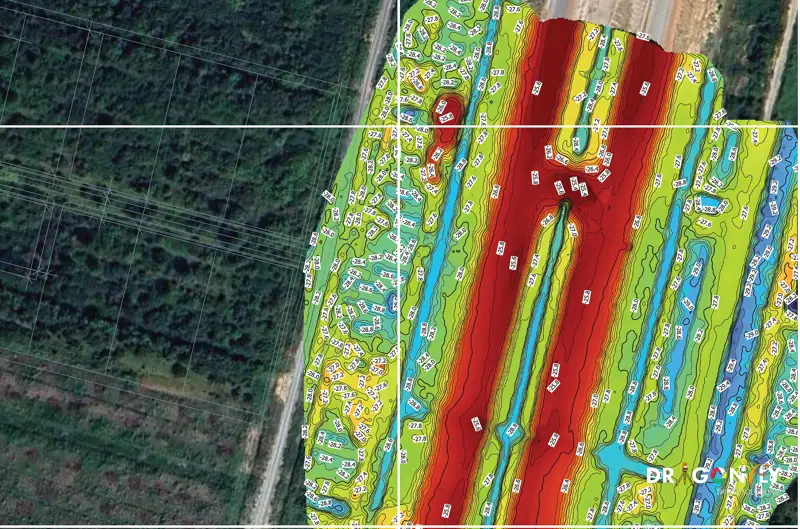
Bare-earth surface models with vegetation and structures removed - the basis for design and drainage work.
Digital Surface Models (DSM)
The surface including vegetation and structures, for clearance and volume analysis.
Contours and elevation datasets
Contour plans at your specified interval, derived from the classified ground returns.
Linear corridor mapping
Continuous profiles and cross-sections along route alignments.
3D reality capture
Measurable three-dimensional models of sites and structures, for design, documentation and clash detection.
LiDAR or photogrammetry?
Both produce terrain data. They are suited to different conditions, and the honest answer is that photogrammetry is often the better value when the ground is visible.
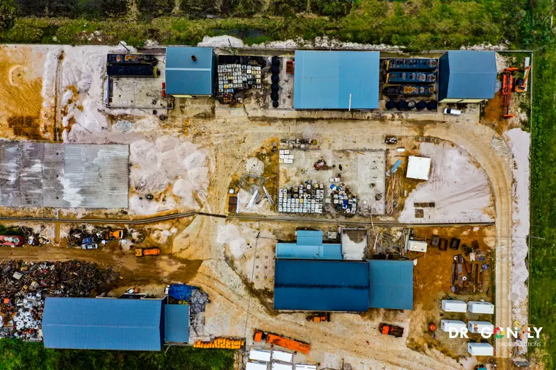
Photogrammetry works well on open ground, bare sites, stockpiles and anywhere the surface can be seen from the air. It is faster, produces colour imagery alongside the measurements, and costs less.
LiDAR is the right choice where vegetation obscures the ground, where a continuous corridor profile is required, or where small elevation differences across flat terrain matter.
Many projects use both - LiDAR for the terrain model, photogrammetry for the orthomosaic. Tell us what the data is for and we will recommend the combination that fits, including when LiDAR is not necessary.
Photogrammetry
- Open ground, bare sites and stockpiles
- Faster to capture
- Colour imagery alongside the measurements
- Costs less
LiDAR
- Vegetation obscures the ground
- A continuous corridor profile is required
- Small elevation differences across flat terrain matter
Frequently Asked
If your question is about a specific site, send us the location and we will tell you what LiDAR can achieve there.
Ask us directlyNot through solid canopy, but through gaps in it. Enough individual pulses reach the ground for the surface to be modelled accurately in most vegetated conditions. Very dense, unbroken canopy reduces ground returns, and we will tell you if a site is likely to be difficult.
A Digital Surface Model includes everything the sensor sees - vegetation, buildings, structures. A Digital Terrain Model is the bare ground with those removed. Design work normally needs the DTM; clearance and volume work often needs both.
Discuss a LiDAR Survey
Tell us about the site, the terrain and what the data is for. We will advise whether LiDAR is the right method and what it would involve.