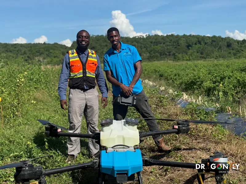
Precision Agriculture Drone Services in Guyana
Treat the areas that need it, not the whole field.
Dragonfly combines drone technology with agronomic data to help Guyanese growers raise yield and reduce input cost.
We provide targeted spray application, multi-spectral crop health mapping, field survey and yield estimation for rice, sugar cane and cash crop operations - principally across the coastal belt, where most of Guyana's commercial agriculture sits.
The principle is straightforward. Conventional application treats a whole field at a uniform rate because that is all a tractor or a manual crew can practically do. Aerial imaging shows which parts of the field are actually under stress, and a spray drone can then treat only those areas, at the rate each needs.
Crop health mapping
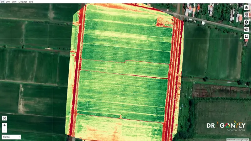
Multi-spectral imaging records light reflected from the crop in wavelengths the eye cannot see, including near-infrared.
Healthy plants reflect near-infrared strongly; stressed plants reflect less, and they do so before the stress is visible from the ground. That gives a map of where the crop is struggling, often days or weeks before a field walk would find it.
What the map does not do is tell you why. Nutrient deficiency, pest pressure, disease and waterlogging can look similar in the data. The imaging tells you where to look; the diagnosis still needs an agronomist on the ground. We work alongside yours, or can point you to one.
Precision spraying
Spray drones apply pesticide, herbicide, fungicide and liquid fertiliser directly to the crop, following a prescription map derived from the health imaging or a flat rate where that is what the job needs.
The practical advantages over ground application:
No wheel damage
Nothing drives through the crop, so there is no tracking loss and no soil compaction.
Works on wet ground
Aerial application continues when fields are too soft to carry a tractor - a real constraint on Guyana's coastal clays.
Faster coverage
A drone covers ground considerably faster than a manual crew, which matters when a treatment window is short.
Less chemical, placed better
Variable-rate application puts product where it is needed rather than across the whole block, reducing both cost and runoff.
Operator safety
Nobody walks through a freshly treated field with a knapsack.
Field survey and yield estimation
Field and boundary mapping
Accurate field areas and boundaries for planning, record-keeping and input calculation.
Drainage and irrigation analysis
Elevation modelling to show how water moves across a field. On Guyana's flat coastal plain, differences of a few centimetres determine where water sits - and that is often the limiting factor on yield.
Yield estimation
Crop condition data through the season to support harvest planning, labour scheduling and forward sales.
Stand counts and gap analysis
Emergence assessment and identification of areas needing replanting.
Crops we work with
Rice
Guyana's largest arable crop. Health mapping across large blocks, targeted treatment, and drainage analysis where water management limits yield.
Sugar cane
Stand assessment, health monitoring across estate-scale areas, and application where ground access is difficult.
Cash crops and horticulture
Smaller blocks with higher value per hectare, where precise treatment and early stress detection pay back quickly.
Regulatory position
Aerial application of agricultural chemicals is regulated. We operate under Guyana Civil Aviation Authority certification, follow label requirements for every product applied, and maintain application records for each job.
- GCAA certification
- Label requirements for every product
- Application records for each job
Frequently Asked
Tell us the crop and the area, and we will tell you what is worth doing and what is not.
Ask us directlyFor most treatments, yes, and in some conditions better - there is no wheel damage, and application continues on ground too wet for a tractor. Product selection and droplet size matter, and we work to label requirements for each chemical.
Where the crop is under stress, often before it is visible from the ground. It shows location, not cause - diagnosis still needs an agronomist, and we work alongside yours.
Discuss Your Operation
Tell us the crop, the area and what is limiting your yield. We will advise what is worth doing and what is not.